- Home
- Simon Winchester
Pacific: Silicon Chips and Surfboards, Coral Reefs and Atom Bombs Page 2
Pacific: Silicon Chips and Surfboards, Coral Reefs and Atom Bombs Read online
Page 2
Germany was next in line to take an interest in the region, driven first by the needs of commerce and then by the pressing demands of pride, expansion, and empire. Spain initially balked at the impertinence of a Northern European rival trying to muscle in on its territory, but eventually acquiesced, and by the end of the nineteenth century, the Marshalls and the Carolines, settled by German traders who established copra and cotton plantations there, came to be administered by German governors. They were protected by a blue-water navy of sorts, the German East Asiatic Squadron, a cruiser force of six ships that eventually settled a fixed base in the docks of Tsingtao,2 in China’s Shandong province.
Meanwhile, in the aftermath of the Spanish-American War, the United States opted to take Guam from Spain, and placed a coaling station there for the convenience of its own fleet. To add to this confusing amalgam, Britain began to nibble away at the eastern parts of Micronesia and took the Gilbert Islands for its own, together with the Ellices, which were nearby (though ethnically Polynesian, like Hawaii and Tahiti and points south and west).
Thus might this cumbersome patchwork of island disarrangement have long remained, but for the outbreak of the Great War. Japan had joined forces with Britain from the very beginning of the conflict, and its navy moved quickly to police the sea-lanes of the western Pacific, at the very least to stop all the German trade there. An immediate task was to chase away the German navy and to occupy what some in Tokyo saw as the commercially interesting and strategically important Micronesian islands. By October 1914, Japanese forces had almost all the islands firmly under their control—with long-term implications that would become much clearer only in the aftermath of the Second World War.
This was to be the third formal occupation of Micronesia. Tokyo newspapers of the time regularly showed photographs of bearded and be-medaled Japanese governors opening sugarcane mills and schools and railway lines on island after island. Such images fed into a general Japanese affection for Nan’yō, the South Seas, and almost certainly helped foster the belief in Japan’s inherent right to govern an even larger part of the region—governance that would eventually be employed, as it happened, for a wider and more sinister purpose. “It is our great task as a people to turn the Pacific into a Japanese lake,” cried a noted historian and Diet member, Yosaburo Takekoshi, toward the end of the Great War. “Who controls the tropics controls the world.”
Back then, few others knew why Tokyo so keenly wanted to occupy Micronesia, other than to sate the widespread nineteenth-century romantic yearning for the South Seas, fanned by the turn-of-the-century popularity of vernacular novels featuring wahini and tropical flowers and pink-hued coral beaches. It was a while before the sentiments of men such as Takekoshi took root, but when they did, such attitudes were swiftly hijacked by soldiers who were much more aggressively nationalistic.
Many in the West were uneasy with the knowledge that the Japanese had taken the Micronesian islands from the Germans by such stealth. It turns out there was ample reason for concern. After 1941 and the attacks on Pearl Harbor, on Malaysia, on Hong Kong, these now formidably well-equipped and well-defended islands (Pulau, Chuuk, Jaluit, and the two Marshall Island atolls to which United 154 was now heading, Majuro and Kwajalein) could be used as bases from which to attack Western forces. And it was clear the Japanese had been preparing them for such roles since back in the 1930s, confirming Western suspicions that Japan’s intentions in taking the islands had been for military domination all along.
I once sailed close by the islands, aboard a Japanese ore-carrying ship. She was the Africa Maru, belonging to Sumitomo Metal, and she was carrying 135,000 tons of rich Australian iron ore from the Mount Newman mine in Western Australia up to the blast furnaces of Kashima, to the east of Tokyo. The steel that would be made soon would be pressed into the bodies and axles of Nissan Sentras and Toyota Corollas, no doubt.
The ship’s captain, a friendly man named Shigetaka Takanaka, asked me up to the bridge one day as we threaded our way through the islands, with Yap and Palau far away to port, Chuuk similarly distant to starboard. He was poring over his nautical chart, a large-scale sea map that indicated the position of all these islands, and of his homeland to the north, and which was titled—whether out of optimism or nostalgia, I couldn’t tell—“The Whole Nippon.” He pointed out those smaller islands that were close enough to see on the radar. One we spotted through binoculars, if hazily: a lone mass of green, possibly the islet of Ifalek or the three-island atoll of Lamotrek. Captain Takanaka gestured around the horizon. “Ours, once upon a time,” he said softly. “All of it. We were given them by the League of Nations. But then they were taken away.” He seemed genuinely regretful.
They had been taken away, indeed, and at a terrible price. American forces recaptured them in the spring of 1944, atoll by atoll, in a stuttering series of appallingly bloody set-piece battles that have since passed into military legend. Chuuk was one of the last outposts for the defeated Japanese: their surrender was not taken until September 1945, almost a month after the great formalized surrender ceremony staged in Tokyo Bay, aboard the USS Missouri. The islands of Micronesia—by some estimates nearly three thousand of them, a mere one thousand square miles of dry land peppered across fully three million square miles of sea—have been American, in essence, ever since. The fourth imperial occupation, some might argue.
And the native people have won precious few benefits from all the centuries of foreign attention. Critics claim, not unreasonably, that all that was brought by the years of foreign trespass in the Micronesian islands has been death, disease, and dependency; its residue remains, and it is not a pretty sight.
Particularly on the atoll known as Kwajalein.
United 154 lands there, its second stop out from Honolulu. Most people are forbidden to disembark, and must remain in the parked aircraft, trusting that its cooling system will survive the punishing afternoon heat. But I had left Honolulu that morning with a permit to land, issued by a forward outpost of the U.S. Army.
For Kwajalein is an army base. Since the 1960s it has operated as a center for mid-ocean rocketry, and it is currently the Ronald Reagan Ballistic Missile Defense Test Site. Few are allowed to get off the plane, fewer still to linger on the atoll, because the site is festooned with a costly array of ultrasecret high-technology apparatus, and is peopled with hundreds of high-technology staff, soldiers, and scientists, who are performing clandestine tasks with the equipment, all officially bent on helping keep America safe from whatever are deemed currently the world’s most dangerous threats.
The atoll is one of the world’s largest, with a lagoon of eight hundred square miles surrounded by almost one hundred islands, slivers of sand and coral that peek just a few feet above the surf. Inside the atoll, the sea is pale blue—the wreck of the German heavy cruiser Prinz Eugen, which turned turtle as it was being towed to haven there, a damaged war prize,3 is plainly visible. Outside the atoll, the sea is night dark, as the waters off the reef edge plunge thousands of feet down. There are the leaning palm trees, the endless rollers, the sound of seabirds, the roasting sun, the white-hot sand.
The actual Kwajalein Island is at the atoll’s southern end, and it serves as the headquarters for this cruelly isolated base. The island extends three miles or so from tip to tip, is a quarter of a mile wide, and sports the base’s aerodrome, water tower, and softball field. In other ways, it is as cheerless and institutional a place as any army base. The majority of those stationed there are civilian contractors, mostly from Alabama, many of them employed by an Alaska-based company that won the management contract from the Pentagon.
Some half dozen times a year, clients, customers, users of the Kwajalein facilities—they are called by many names—fire missiles from pads at Vandenberg in California and Kodiak in Alaska toward the atoll, to see how well they work. The rockets, of many different kinds and weights and speeds and newness, with many different kinds of warheads, all dummies of course, roar in and are tracked, measu
red, noted, and scored by the long-range telescopes and radars with which Kwajalein is equipped. It’s all a multimillion-dollar game of darts, the accuracy of the weapons’ splashdowns measured in inches, after a four-thousand-mile flight.
Once in a while specialist soldiers on Kwaj, as most call their unlovely home, will fire their own missiles up toward the incoming warheads, and score how well they knock them down, creating their own multimillion-dollar skeet shoot—that has implications, all are assured, for the preservation of world peace.
The rocketry on Kwajalein is impressive, beautiful even—a nighttime test in particular can be quite memorable, with streaks of what looks like orange tracer fire lighting up the sky, and enormous plumes of phosphorescent water where the missiles hit the ocean. But what is seldom seen by visitors is the other side of Kwajalein—where the islanders themselves are obliged to live.
For almost no Marshall Islanders are permitted to stay overnight on Kwajalein Island. They have to leave each evening on a U.S. Army ferryboat, and are shuttled three miles northward up the lagoon, to the island of Ebeye—twelve thousand men, women, and children compelled to live on a squalid eighty acres of slum houses, in what is one of the most densely populated places on earth.
It is a pullulating, smelly, fetid, and degrading place, in appearance more like a slum in Bombay or Calcutta than a community in a country that enjoys “free association” with the United States. There is little by way of a proper sewage system. The schools are ill-equipped; the children—and half the population is under eighteen—ill-educated. The most common disease is diabetes, type 2; the one supermarket, run by a genial Irishman on contract to a company in Guam, sells improbably vast tonnages of sodas and Spam.
Melancholy sights are everywhere. Since there is no Laundromat on Ebeye, those wishing to wash their clothes must come on the ferryboat to Kwajalein and use machines set up in a wire-enclosed compound outside the security fence, while the workers who have permission, and the uniformed Americans who live on the base, cycle past just feet away. There is no mortuary on Ebeye, either; the dead must be brought to Kwajalein, placed in a freezer outside the chain-link fence, and stored there beyond America proper, awaiting burial.
Seldom are the realities of the first and third worlds placed so tantalizingly close to one another—even the realities of Mexican poverty are largely out of sight to most passersby beyond the iron fences in Arizona. But on Ebeye, the separation of the two cultures is cruelly and harshly visible, just inches apart—and with the shame of it made all the more damning because the islands—the entire atoll, the neighboring islands, the entire republic—make up the country that is the birthright of the very people who are now being denied access to it.
This is the Marshall Islands, and these are the Marshall Islanders. Yet international agreements signed in U.S. government offices thousands of miles away have decreed that these men and women and their thousands of children are now forbidden to inhabit large parts of their own island homeland. They must perforce wash their clothes and attend to their dead and be otherwise separated behind chain-link fences, while Alabamans and other strangers on the far side of the same fences come and go on the Marshall Islands quite as they please.
Moreover, there is also the matter of the Money. The U.S. government has a long-term agreement with the government of the Marshall Islands to lease eleven of the islets that rise around the Kwajalein lagoon. Kwajalein Island itself is the biggest and most important of these; but at the north end of the atoll, the outcrop of Roi-Namur has a large airfield also; and many gigantic radar installations and telescopes; and impossibly large long-range-missile-spotting cameras, too—and a small, dignified cemetery for the Japanese war dead (with bones still being found, often frustratingly indistinguishable from the bones of dead American marines). Nine other islands also have launch pads and sensor arrays and target crosses painted on thick concrete pads, which some of the Vandenberg birds, as they are called, are supposed to hit.
For all this, the Marshall Islands government receives many millions of U.S. taxpayer dollars each year—$18 million under the current agreement, on a lease that expires in 2066, with a twenty-year extension. There is a meta-agreement, too: a much more substantial sum is paid by Washington based on what is known as the Compact of Free Association, which essentially gives all the component island groups of Micronesia (of which the Marshalls are one) a guarantee of additional financial aid in exchange for the United States’ being able to make use of the islands more or less as Washington wishes (the “more or less” being somewhat open to negotiation).
But the $18 million annual payment for the use of the Kwajalein islands is earmarked specifically for Kwajalein, which leads any visitor to the pressing question: where does all the money go and why are places such as Ebeye Island such sinks of squalor and poverty? It is a mystery, and it hints at much that is wrong, and has been wrong for generations. Every islander to whom I spoke about it tended to look at the ground and try to change the subject. I got only vague answers that usually mentioned something about the peculiar tribal arrangements of the Marshall Islanders, the traditional structures of power and authority, and the behaviors of the local kings and tribal chiefs, men who are widely respected and deferred to and who often hold elected positions of power.
There are mutterings, too, about the cost of maintaining large houses in Hawaii, which many of the senior figures in the Marshall Islands are said to own. But little is said or written directly about the dispiriting situation of so much poverty in a place where such an abundance of American government money has been so liberally sprinkled about. One University of Hawaii academic who wrote a book purporting to expose this very evident corruption was delayed for years, awash in threatened lawsuits. And though the book was eventually offered for sale, the publisher insisted it be heavily bowdlerized so as not to offend any of the local chieftains.
To add to the general wretchedness of the Marshalls, there is also the nagging matter of Bikini, a lonely but infamous atoll two hundred fifty miles farther north, but also part of the republic. In its pre-atomic existence Bikini was so typically Pacific that it could well have been on a National Geographic cover or a cafeteria poster or the jacket of an old South Seas novel—but it has since become notorious around the planet, ever since the first nuclear weapons were exploded there, back in the late 1940s. The evident misappropriation of funds on Kwajalein, and the fate of the Kwajalein islanders who are forbidden to live on most of their own atoll, constitutes a sorry enough story. But it pales in comparison with the fate of the Bikinians, on whose homeland most of America’s atomic weapons were to be exploded. It is a continuing saga of dispossession also, since these islanders, too, are exiled from home, compelled to live hundreds of miles away, and (as we shall see in the pages that follow) in all too many cases suffering from a florid array of ailments of body and mind. Theirs is a tale—dispiritingly familiar in this corner of the ocean—from which no one in authority emerges with any measureable degree of credit.
The Pacific is an oceanic behemoth of eye-watering complexity. A near-limitless range of human and natural conditions exists within its borders, as one would expect of something so unimaginably enormous. Arthur C. Clarke once remarked, with droll prescience, that a space traveler, upon seeing our planet, would say that calling it Earth was a grave misnomer, since most of it is so obviously Sea. He must surely have been thinking of the Pacific, since its blue expanse entirely dominates the planet.
Its dimensions are staggering. It occupies almost one entire hemisphere. Looking westward, from Panama, and from where Balboa stood on his high peak in the Isthmus of Darién, across to the first encountered landmass of the eastern Malaysian coast, there are more than 10,600 miles of uninterrupted sea. From north to south, from the fogs and shivering waters of the Bering Strait down to the ice cliffs of Marie Byrd Land in Antarctica, is nearly nine thousand miles. The sixty-four million square miles in between fill almost one-third of the planet’s surface. Forty-fi
ve percent of the planet’s total surface waters are found in the Pacific Ocean, and seven miles down, it has the earth’s deepest trenches. In short: everything about the Pacific, the last ocean to be found by Western man, presents an unchallengeable superlative.
It is also not easy to get into, or out of, and this difficulty insulates it from the rest of the world’s oceans. Except for vessels bold enough to try the Bering Strait, between Russia and Alaska, or the gale-whipped seas that fringe the Antarctic, the Pacific enjoys no entranceway that is more than three hundred miles wide. Ships trying to enter from the Indian Ocean must make their way through a litter of islands scattered between Malaysia and Australia, the so-called Maritime Continent. Except for the Strait of Magellan, far down south, there is no natural entrance whatsoever on the American side. Only the Panama Canal, that narrow funnel gouged artificially through the isthmus in the early twentieth century, permits carefully sized ships from the Atlantic the luxury of a quick and easy transit.
The vast distances inherent in the Pacific’s geography have consequences seldom known elsewhere. Consider the Republic of Kiribati, for instance, once the British-run Gilbert Islands. Its one hundred thousand inhabitants are spread over fully 1.35 million square miles of ocean. Two thousand miles from Tarawa, its administrative capital, lies Kiritimati Island—the Christmas Island where the British tested their atom bombs back in the 1960s, without evacuating any of the locals. Not only are these five thousand Kiribatians inconveniently distant from their country’s capital, but they also are on the other side of the equator from Tarawa, and live on the day-before side of the International Date Line. So a summer Sunday on Tarawa is a winter Saturday on Christmas. Small wonder Kiribati struggles, having to cope with such logistical madness. It is one of the world’s poorest countries: the seaweed and copra and fish it harvests are too expensive for most locals, so many of its menfolk are obliged to work abroad or to crew on long-distance cargo ships, remitting their paychecks home, both to keep their families in victuals and in the hope of keeping their country’s pitiful economy alive. Size can be impressive, or it can be an impressive nuisance.
 The Surgeon of Crowthorne
 Pacific: Silicon Chips and Surfboards, Coral Reefs and Atom Bombs
 Korea: A Walk Through the Land of Miracles
 The Men Who United the States: America's Explorers
 Outposts: Journeys to the Surviving Relics of the British Empire
 Atlantic: Great Sea Battles, Heroic Discoveries, Titanic Storms
 The Professor and the Madman: A Tale of Murder, Insanity
 A Crack in the Edge of the World
 The Perfectionists: How Precision Engineers Created the Modern World
 The Man Who Loved China: The Fantastic Story of the Eccentric Scientist
 The River at the Center of the World: A Journey Up the Yangtze
 The Fracture Zone: My Return to the Balkans
 The Map That Changed the World
 Krakatoa: The Day the World Exploded
 The Man Who Loved China
 The River at the Centre of the World
 Bomb, Book and Compass
 The Perfectionists
 The Meaning of Everything
 Exactly
 Atlantic
 Korea
Korea The Fracture Zone
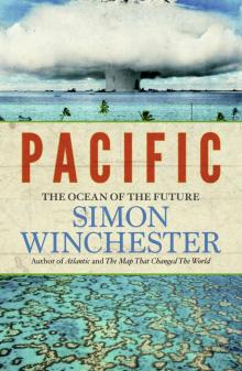 Pacific
 Krakatoa
 The Professor and the Madman
 Outposts